Steve Kaliher (after)
Harry D. White (after)
Set of Four World War II 79th Infantry Maps:
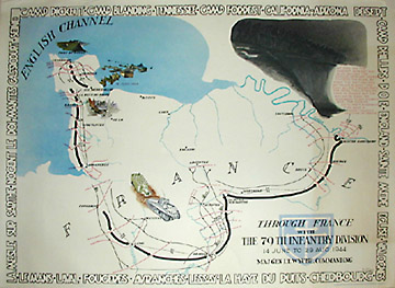
Through France with the 79th Infantry Division 14 June to 29 Aug, 1944
To Belgium and Back with the 79th Infantry Division 31 Aug to 25 Oct,1944
To the Rhine with the 79th Infantry Division 25 Oct to 14 Feb, 1945
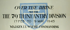
Over The Rhine with the 79th Infantry Division 17 Feb to 9 May, 1945
Pritz Busche Druckerieges. M. B. H., Dortmund, Germany: c. 1946
Color process prints
26.5 x 33.5 inches each
Sold, please inquire as to the availability of similar items.

Set of Four World War II European Battle Maps
After Steve Kaliher and Harry D. White, c. 1946
After Steve Kaliher and Harry D. White, c. 1946
This item is sold. It has been placed here in our online archives as a service for researchers and collectors.
- Please inquire as to the availability of similar items currently in stock, or use the navigation bar above to browse our site for currently available items.
- Find guidelines for the use of images from georgeglazer.com.
- To see more archived items, view our directory.
- Find information about selling your art and antiques.
 |
 |
 |
|
  |
  |
 |
 |
 |
 |
  |
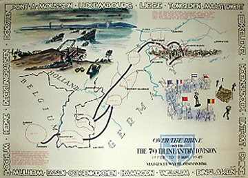  |
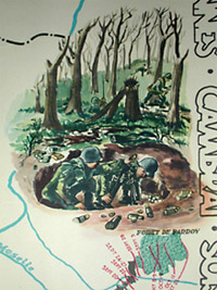
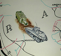
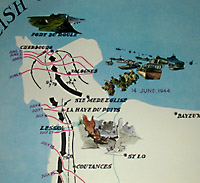
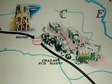
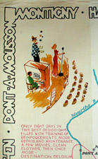
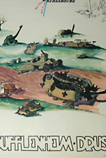
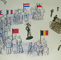
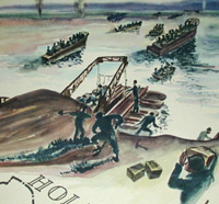
Series of four maps showing the movement of the U. S. Army 79th Infantry Division, under the command of Major General Ira T. Wyche during the final months of World War II. Each map features illustrations of troop movements and is bordered by names of the towns and cities they passed through. The series begins with the D-Day landing in Normandy in June 1944, and documents the push west over the next several months, through France, Belgium and the Rhine Valley, ending on Victory in Europe Day. After April 13, the division went on occupation duty in the Dortmund, Sudetenland and Bavarian areas until its return to the U.S. These maps were printed in Dortmund, evidently while the 79th Infantry was still there.
The maps are embellished with illustrations of military vehicles and landmarks, as well as some larger pictures such as soldiers in a foxhole in To Belgium and Back and a battlefield littered with destroyed vehicles in To the Rhine. Captions appear throughout the series giving dramatic historical accounts of events, such as the following: "At 2130 on the darkest, rainiest Aug 19 on record the division received orders to cross the seine. By 0300 the 313th had one battalion across-the first allied troops over the seine. The Luftwaffe came in swarms but the 463 AAA BN made the homeward flight a lonely ride. The division artillery's murderous fire made a continuous pattern of death."
Reference:
"79th Infantry Division." CMH Online. 30 November 2001. http://www.army.mil/cmh-pg/lineage/cc/079id.htm (12 May 2003).