G.V.S. Ryerson (artist)
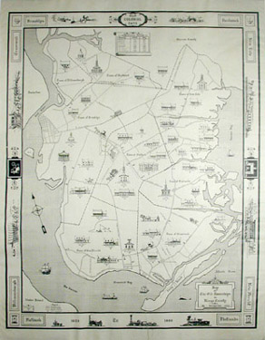
Map of the Old Townships in Kings County
New York: 1944
Black and white print
25 x 20 inches, overall
23 x 19 inches, image
Sold, please inquire as to the availability of similar items.

Historical Map of Brooklyn
by G.V.S. Ryerson, 1944
by G.V.S. Ryerson, 1944
This item is sold. It has been placed here in our online archives as a service for researchers and collectors.
- Please inquire as to the availability of similar items currently in stock, or use the navigation bar above to browse our site for currently available items.
- Find guidelines for the use of images from georgeglazer.com.
- To see more archived items, view our directory.
- Find information about selling your art and antiques.
 |
 |
 |
 |
 |
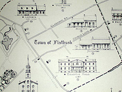 |
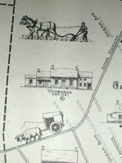
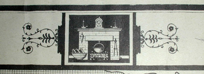
Historical map published in 1944 showing the colonial townships of Kings County, Brooklyn: Brooklyn, Bushwick, New Lots, New Utrecth, Flatlands, Flatbush, Williamsburgh and Gravesend. Old Dutch roads and streets present at the time of publication are shown. Illustrations of historic buildings appear throughout, with those still standing at the time of publication indicated.
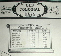
A decorative border displays scenes from Brooklyn's development, including horse-drawn carriages and trolleys. The evolution of the steam powered train appears from 1829 to 1860 in the lower border. A chart of historical data in the top center gives the year of settlement of each village and the year in which each became a city.